UN Backs New World Map Showing Africa’s True Size as US Stands Alone in Opposition

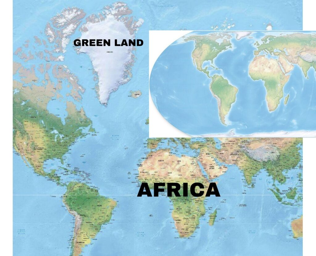
A decades-old debate over how the world is represented on maps has taken a new turn after the United Nations General Assembly overwhelmingly backed a resolution promoting a more geographically accurate depiction of the world, particularly the size of Africa.
The resolution, introduced by Togo and supported by the African Union, received 164 votes in favour, six abstentions and just one vote against, from the United States.
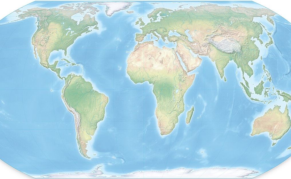
At the centre of the initiative is the Equal Earth projection, a map design developed in 2018 that represents continents according to their relative land areas more accurately than the widely used Mercator projection.
The campaign, known as #CorrectTheMap, seeks to address what African governments and campaigners describe as a long-standing distortion in the way Africa is visually represented around the world.
The Mercator projection was created in 1569 by Flemish cartographer Gerardus Mercator, primarily to assist sailors with navigation. While it remains useful for maritime and aerial navigation, it significantly exaggerates the apparent size of territories as they move farther from the Equator.
On a conventional Mercator map, Greenland can appear roughly comparable in size to Africa. In reality, Africa is about 14 times larger than Greenland.
The Equal Earth projection attempts to correct this problem by preserving the relative areas of continents, giving viewers a much more realistic understanding of Africa’s enormous geographical scale.
The African Union had already endorsed the Equal Earth projection earlier in 2026 and called for efforts to correct disproportionate representations of Africa on world maps.
Although the resolution attracted overwhelming international support, the United States rejected it.
The US argued that the initiative was driven by an ideological agenda and that the United Nations should instead concentrate on more pressing international challenges, including peace and security.
The American opposition did not prevent the resolution from passing.
The measure is not legally binding, meaning countries are not required to abandon the Mercator projection. Instead, it encourages governments, schools, international organisations and technology companies to consider more accurate projections, including Equal Earth.
For African supporters, the campaign is about more than simply changing the appearance of a classroom map.
Togo, which led the initiative, has linked the campaign to broader efforts to confront the legacy of colonial-era representations of Africa. Officials argue that repeatedly seeing Africa visually reduced on maps can influence perceptions of the continent’s importance and place in the world.
Togo’s Foreign Minister Robert Dussey has described the initiative as a matter of geographical accuracy, historical memory and what he called “cognitive justice.”
The country has said it intends to update its school geography materials and encourage other governments, educational institutions and technology companies to adopt more accurate representations.
Campaigners say the ultimate goal is to see accurate maps used in schools, textbooks, newsrooms, businesses and digital platforms across the world.
The UN decision therefore does not mean that the Mercator map has been banned. Rather, it marks a major international endorsement of efforts to use maps that provide a more accurate picture of the relative size of the world’s continents, with Africa taking a much more prominent place on the global map.
 TUW
TUWRelated Contents